Let’s say you’re planning one of those legendary road trips – Route 66 in the US or Scotland’s North Coast. A quick search will reveal applications and websites that let you choose destinations, set limits on driving time, recommend stops and places to stay and eat. Once you’re done, you can even play around with the resulting route to create any meandering path that fits your fancy.
Now, let’s say that you’re planning a bus route. Obviously, there are no equivalent “free bus road trips apps”. But, instead of working on dated maps, using pen and paper, and then trying to derive travel times and stops (timetables, in short), wouldn’t you prefer the same experience? Moreover, wouldn’t you plan more routes, adaptations and responses to seasonal changes were the planning process as simple as planning a road trip?
Looking at the current state of mass transport route (and timetable) planning software, no wonder that whilst rider demand changes daily, weekly and seasonally, routes are kept constant with some systems using the exact same routes for over thirty years. To change this, Route Planning software needs the following four characteristics:
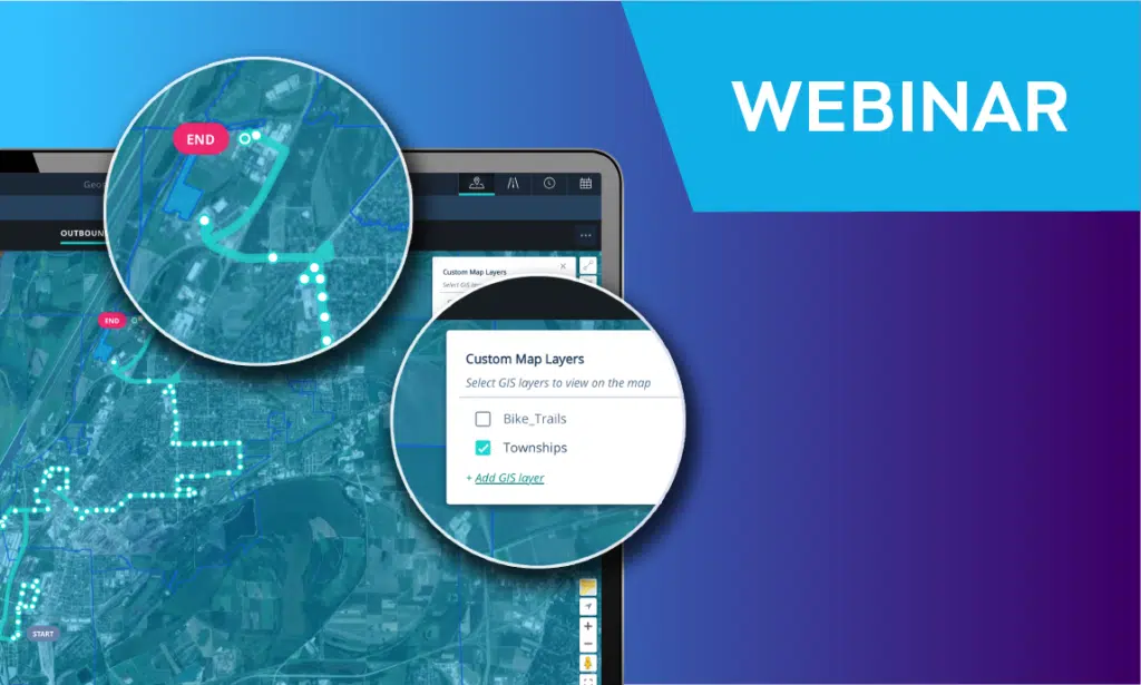
- Visual: letting planners “see for themselves” always makes work better. Using a combination of a map, satellite and street level pictures lets planners visualize routes quickly by dragging and dropping “checkpoints”, verifying that bus stops are there and moving them if needed and more actions that are much faster when done in a visual and interactive way.
- Seamless: as in pulling a route’s data from GTFS and having an immediate visualization on an interactive map, as in seeing a bus stop and checking its picture.
- Precise and updated: having maps with recent data and precise data that is verifiable with street level pictures makes work much faster.
- Integrated: route planning is the first step in the mass transport process. Next up are timetables, vehicle and crew schedules and last, but not least, rosters. It’s important that route data immediately integrates into the timetable, allowing for different patterns, setting travel times and more, in an automated way that can be validated (i.e. that planners get notified when a timetable contains an error).
This is exactly what Optibus is about. Most scheduling and planning tools used today are inflexible and require long, laborious processes to make the simplest route changes. Our overarching goal is to modernize mass transportation tools so that agencies and operators can better serve passengers by adapting routes to match demand. We’ve created a visual, integrated and intelligent route planning tool on a cloud-native platform to achieve that vision.
Here’s a demo video:
Read our latest articles:
Relief Vehicle Scheduling
Multi route planning
Bus rapid transit systems planning
Electric vehicle optimization